Table of Contents
- Introduction
- The Importance of Hands-On Geography
- Edible Landform Projects: Combining Science and Snacks
- Classic Craft-Based Landform Models
- Teaching STEM Through Erosion Experiments
- Identifying Landforms by Age Group
- Integrating Art into Geography Projects
- Why Modeling Outperforms Memorization
- Planning a Landform Project Day
- Connecting Landform Projects to History and Culture
- Using Technology as a Supplement
- How to Handle the "Mess"
- Creative Alternatives to Common Materials
- Fostering a Lifelong Love for STEM
- FAQ
Introduction
Standing at the base of a tall hill or looking across a wide river, children often have endless questions. They want to know why the earth curves, how mountains grow so high, and where the water in a canyon comes from. These natural features, or landforms, are the building blocks of our planet’s geography. For parents and educators, moving beyond a textbook to explain these concepts can feel like a tall order. However, the most effective way to help a child understand the world is to let them build a miniature version of it themselves.
At I'm the Chef Too!, we believe that learning should be as delicious as it is educational. By blending STEM, the arts, and culinary exploration, we turn complex subjects like geology into "edutainment" experiences. This guide covers a wide variety of landform projects for kids, ranging from edible creations to sensory art projects. Whether you are a teacher looking for a classroom activity or a parent planning a screen-free weekend, these projects will spark curiosity and build confidence. For more hands-on geography ideas, explore our geography STEM activities for kids.
Through hands-on play, children transform from passive observers into active explorers of the Earth’s surface. This article explores how to use simple household items and kitchen staples to teach geography and science effectively.
Quick Answer: Landform projects for kids use hands-on materials like salt dough, clay, or food to model Earth's physical features. These activities help children visualize geography concepts like mountains, valleys, and plateaus while integrating STEM and art.
The Importance of Hands-On Geography
Geography is more than just memorizing names on a map. For many children, a flat map is an abstract concept that is hard to connect to the real world. Hands-on projects bridge this gap by adding a third dimension. When a child physically builds a mountain or carves out a riverbed, they are engaging their kinesthetic memory. This type of learning sticks much longer than reading a definition.
STEM and geography are naturally linked. To build a landform model, a child must use engineering skills to ensure their structures stand tall. They use mathematical measurement to get the proportions right. They also explore earth science by looking at how water and wind change the land over time. By combining these subjects, we create a more holistic educational experience.
Creative play reduces the "fear of being wrong." In a traditional test, a child might worry about forgetting the definition of a plateau. In a project-based environment, they are free to experiment. If their salt dough mountain collapses, it becomes a lesson in structural integrity rather than a failure. This builds a growth mindset that serves them in all areas of life.
Edible Landform Projects: Combining Science and Snacks
Using food as a medium for learning is one of our favorite ways to engage children. It appeals to multiple senses—sight, touch, smell, and taste. When you use edible materials for landform projects for kids, the kitchen becomes a laboratory where science and art meet. Families who enjoy combining cooking with learning can also browse our one-time adventure kits for ready-to-use activities.
The Edible Topographic Map
A topographic map shows the different elevations of the land. You can create a tasty version of this using a sturdy base and various snacks to represent different features.
- Start with a flat base. A large graham cracker or a thick piece of flatbread works perfectly as the "crust" of your world.
- Add the "water." Use blue frosting or a thin layer of blueberry jam to mark where oceans, lakes, and rivers flow.
- Build the mountains. Use chocolate chips, mini marshmallows, or mounds of peanut butter to create peaks.
- Form the plateaus. Flat-topped crackers or square pieces of cheese can represent these high, flat areas.
- Create the plains. Green sprinkles or finely shredded coconut dyed with green food coloring can represent vast grasslands.
Rice Cereal Treat Valleys and Canyons
Rice cereal treats are an excellent engineering material because they are sticky and moldable. This makes them ideal for teaching the difference between a valley and a canyon.
Step 1: Prepare the mixture. / Follow a standard recipe to make a warm, pliable batch of cereal treats.
Step 2: Shape the base. / While the mixture is still warm, press it into a rectangular pan, but keep it thick.
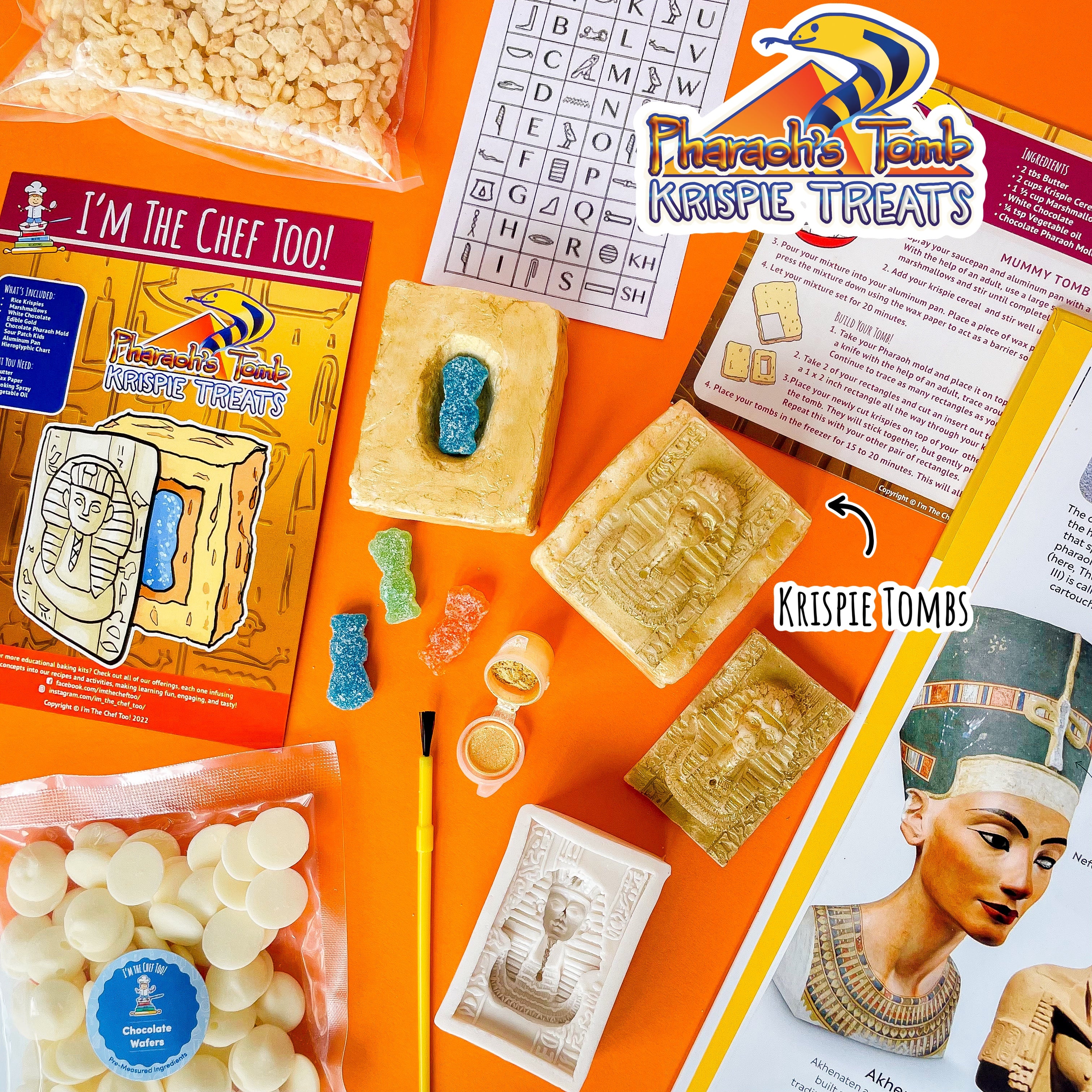
Step 3: Carve the landform. / Use a plastic knife or a spoon to "erode" a path through the middle. A V-shape represents a valley formed by glaciers or rivers. A deep, narrow slit with steep walls represents a canyon.
Step 4: Add the water source. / Pour a small amount of blue-tinted honey or syrup through the carved path to show how water continues to shape these features.
Erupting Volcano Cakes
Volcanoes are one of the most exciting landforms to study because they involve dramatic changes. We often use the Erupting Volcano Cakes kit to teach children about chemical reactions and geology at the same time. This project shows how pressure builds up beneath the Earth's surface.
As the "lava" flows over the sides of the cake, children can see how new land is formed by cooling magma. This is a perfect example of edutainment, where the excitement of a "volcanic eruption" makes the science lesson unforgettable. It combines the chemistry of an acid-base reaction with the culinary art of baking.
Key Takeaway: Edible projects turn abstract geography into a sensory experience that improves retention and makes complex science concepts accessible to young learners.
Classic Craft-Based Landform Models
If you prefer projects that can be kept on a shelf for a long time, traditional craft materials are the way to go. These landform projects for kids allow for more detail and can be used as a reference for future lessons. For another creative geography activity, try one of these hands-on geography crafts for kids.
The Salt Dough Island
Salt dough is a staple in many households and classrooms for a reason. It is inexpensive, easy to make, and dries into a hard, paintable surface. Building an island allows children to include multiple landforms in one project.
- Make the dough. Mix two cups of flour, one cup of salt, and one cup of water. Knead it until it is smooth.
- Create the foundation. Use a sturdy piece of cardboard or a plastic tray as the base.
- Sculpt the features. Encourage your child to include at least five different landforms. They might add a volcano with a crater, a winding riverbed, a flat plateau, a series of rolling hills, and a peninsula jutting out into the "sea."
- Dry and paint. Once the dough is dry, use acrylic paints to bring the island to life. Use shades of brown for mountains, green for plains, and blue for the surrounding water.
Shoebox Dioramas
Dioramas are excellent for focusing on a specific environment, such as a desert or a mountain range. They allow children to tell a story about the land and the animals that live there.
Step 1: Choose a theme. / Decide if the diorama will represent a specific landform, like the Grand Canyon, or a mix of several.
Step 2: Create the background. / Paint the inside of the shoebox to look like the sky and the horizon. This adds depth to the project.
Step 3: Build the terrain. / Use crumpled paper or clay to build up the ground. Cover the paper with "sand" (cornmeal) or "grass" (green felt).
Step 4: Add details. / Use small pebbles for boulders and twigs for trees. Label each landform with a small paper flag so the child can practice their vocabulary.
Shaving Cream Sensory Trays
For younger children, a sensory tray is a mess-managed way to explore shapes. Fill a shallow tray with shaving cream. Ask the child to use their hands to push the cream into different shapes. Can they make a mountain with a pointy peak? Can they make a flat plain? This tactile experience is a great precursor to more complex modeling projects.
Teaching STEM Through Erosion Experiments
Landforms are not static; they are constantly changing. Introducing the concepts of weathering and erosion through landform projects for kids adds a layer of earth science to the geography lesson. You can extend this topic with a simple volcano project for kids.
The Sugar Cube Erosion Test
This activity demonstrates how water can break down solid rock over time. It is a simple way to visualize a process that usually takes millions of years.
- Build a "mountain" out of sugar cubes. Stack them in a pyramid shape on a plate.
- Add "rain." Use a medicine dropper to slowly drip water onto the top of the mountain.
- Observe the changes. Watch as the sugar cubes begin to dissolve and lose their shape.
- Discuss the results. Explain that in nature, rain and rivers do the same thing to real mountains. This is how valleys and canyons are formed.
Sand and Water Flow Tables
A sand tray can show how water creates paths and changes the landscape.
- Set up the tray. Tilt a plastic bin slightly by placing a book under one end. Fill it with sand.
- Form the land. Create a series of hills and mounds in the sand.
- Simulate a river. Slowly pour water from the high end of the tray.
- Watch the path. The water will naturally find the easiest path through the "hills," creating a riverbed and eventually a delta at the bottom.
Key Takeaway: Erosion experiments help children understand the "why" behind landforms, moving beyond simple identification to understanding geological processes.
Identifying Landforms by Age Group
Not every project is suitable for every age. Tailoring landform projects for kids to their developmental stage ensures they stay engaged without getting frustrated.
| Age Group | Focus | Recommended Activity |
|---|---|---|
| Preschool (Ages 3-5) | Basic shapes and sensory play. | Shaving cream mountains or play dough shapes. |
| Early Elementary (Ages 6-8) | Identification and simple models. | Salt dough islands or edible topographic maps. |
| Upper Elementary (Ages 9-12) | Geological processes and detail. | Erosion experiments or Erupting Volcano Cakes. |
| Middle School (Ages 12+) | Mapping and engineering. | Creating a scaled topographic model of a real location. |
Tips for Preschoolers
Keep it simple. At this age, children are just beginning to understand that the Earth has different parts. Focus on the big three: mountains, water, and flat land. Use a lot of "touch and feel" materials. If you are making a mountain, talk about how it feels "bumpy" or "tall."
Tips for Elementary Students
This is the perfect age for dioramas and "create your own country" projects. They are old enough to understand more specific landform names like peninsulas, isthmuses, and deltas. Encourage them to use labels and write a few sentences about each feature they create.
Tips for Educators and Homeschoolers
When teaching a group, you can assign different landforms to different students. One group can focus on "Water Forms" like bays and straits, while another focuses on "Land Forms" like plateaus and buttes. At the end, they can join their projects together to create one giant classroom map. This encourages collaboration and communication. Educators planning group learning can explore school and group programmes designed for shared experiences.
Integrating Art into Geography Projects
The "A" in STEAM (Science, Technology, Engineering, Art, and Math) is vital for engagement. Art allows children to express their unique perspective on the world.
Watercolor Landform Paintings
Painting is a relaxing way to review geography. Teach children how to use different brush strokes to represent different terrains. Short, dabbing motions can look like a forest on a hill. Long, smooth strokes can represent a calm lake.
Collage Maps
Gather old magazines, fabric scraps, and textured paper. Ask your child to create a map using only these materials. They might use blue corduroy for a river or sandpaper for a desert. This challenges them to think about the physical textures of the earth.
Landform Photography
If you are able to take a walk in a local park or nature preserve, bring a camera. Have your child take photos of any landforms they see—even small ones like a hill or a creek. When you get home, print the photos and have them label the landforms they found. This connects their indoor projects to the real world outside their door.
Why Modeling Outperforms Memorization
Many of us remember memorizing lists of definitions in school. However, studies in educational psychology suggest that active learning leads to better long-term retention.
Myth: Kids need to memorize definitions before they can do a project. Fact: Doing the project helps kids understand the concept so well that the definition becomes intuitive.
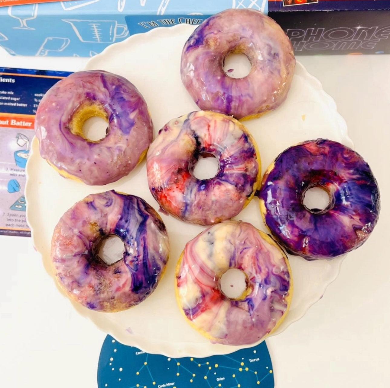
When a child builds a Galaxy Donut Kit or a volcano cake, they aren't just following a recipe; they are exploring the structure of the universe or the earth. They are seeing how different parts fit together. This spatial reasoning is a critical skill for future scientists, engineers, and architects.
Building landform models also improves fine motor skills. Rolling dough, carving cereal treats, and painting small details all require hand-eye coordination. For younger children, these "fun" projects are actually important developmental exercises.
Projects encourage critical thinking. When a child is building a plateau, they have to figure out how to make the top flat while keeping the sides steep. This is a mini-engineering challenge. If their plateau slumps into a hill, they have to problem-solve. Why did it happen? Was the dough too wet? Was the base too narrow? These are the questions that lead to a scientific mindset.
Planning a Landform Project Day
To make your project day successful, a little preparation goes a long way. This ensures the focus stays on the fun and the learning rather than the mess.
Step 1: Gather your supplies. / Check your pantry for flour, salt, and food coloring. Collect cardboard boxes and recycled plastics for bases.
Step 2: Set expectations. / Remind children that this is an exploration. Their models don't have to look perfect; they just need to represent the landforms.
Step 3: Define the "Must-Haves." / Give the child a list of 4–5 landforms they must include in their project. This keeps them on track with the educational goals.
Step 4: Document the work. / Take a photo of the finished project. Ask the child to give you a "tour" of their land, explaining each feature. This reinforces their verbal communication skills and vocabulary.
Bottom line: Preparation and clear goals allow children to lead their own learning process, which builds their independence and confidence in STEM subjects.
Connecting Landform Projects to History and Culture
Landforms don't just exist in a vacuum; they shape how people live. You can expand your landform projects for kids by talking about the human element.
- Where do people build cities? Usually on plains or near rivers for easy transport.
- How do mountains protect people? They can act as natural barriers.
- Why are deltas important for farming? The soil is often very rich there because of the silt brought down by the river.
By adding these questions to your project time, you turn a geography lesson into a social studies lesson. This helps children see the "big picture" of how our physical world affects our daily lives.
Using Technology as a Supplement
While we advocate for screen-free play, technology can be a great way to "scout" for your project.
- Satellite views. Use online map tools to show your child what their neighborhood looks like from above. Can they spot any hills or ponds?
- Virtual tours. Many national parks offer virtual tours. Watching a video of the Grand Canyon before building a model can help a child get the colors and shapes right.
- Time-lapse videos. Show a time-lapse of a volcano erupting or a glacier moving. This gives them a sense of the power and movement behind the landforms they are building.
Using these tools for five or ten minutes before starting a hands-on project can provide great inspiration.
How to Handle the "Mess"
Many parents and educators shy away from hands-on projects because of the cleanup. However, the benefits of "messy play" are well-documented. It allows for a level of freedom and discovery that tidy activities simply can't match.
- Use trays. Working inside a large baking sheet or a plastic bin keeps sand and dough contained.
- Designate a "Lab Zone." Use a kitchen table or a craft area that is easy to wipe down.
- Involve the kids in cleanup. This is a part of the scientific process, too. Cleaning up after an "experiment" teaches responsibility and organization.
- Choose pre-measured kits. For those days when you want the fun without the measuring and prep, kits like ours at I'm the Chef Too! provide everything you need in the right amounts. This significantly reduces the mess and the stress for the adult.
For families who want more ready-to-go activities, explore our full kit collection.
Creative Alternatives to Common Materials
If you don't have flour or salt on hand, you can still complete landform projects for kids using these everyday items:
- Lego Bricks: Use different colors of bricks to build a 3D topographic map. Blue for water, green for land, and white for snow-capped peaks.
- Old Clothes: Roll up green t-shirts to make hills and lay out blue jeans to represent a river. This is a great "living room" project that requires zero cleanup.
- Outdoor Materials: If you have a yard or access to a park, use dirt, rocks, and leaves. Building a landform model in the "real world" is the ultimate way to connect with nature.
Fostering a Lifelong Love for STEM
The goal of these landform projects for kids is not just to teach them the difference between a hill and a mountain. It is to ignite a spark of curiosity about how our world works. When children are given the tools to create, they realize that they are capable of understanding complex systems.
By bringing landforms into the kitchen or onto the craft table, we make science approachable. We show children that learning isn't something that only happens while sitting at a desk. It happens when we are mixing dough, painting a sunset, or watching a "volcano" overflow on the kitchen counter.
We are proud to support families and educators on this journey. Our mission at I'm the Chef Too! is to make learning a joyful, shared experience. We believe that when you combine the arts with STEM and a little bit of culinary magic, you create memories that last a lifetime. Whether you are building an island out of salt dough or baking your way through the solar system with our subscription, you are giving your child the gift of wonder.
The next time your child asks a question about a mountain or a valley, don't just reach for a book. Reach for some flour, some paint, or a kitchen spoon. The best way to learn about the world is to build it, one landform at a time. To keep the learning going with a new adventure delivered every month, join The Chef's Club.
FAQ
What are the most common landforms to include in a project?
The most common landforms for kids to learn are mountains, hills, valleys, plateaus, and plains. Including water features like rivers, lakes, and islands helps provide a complete picture of the Earth's surface.
Is salt dough better than clay for landform projects?
Salt dough is often preferred because it is made from common pantry items and is very budget-friendly. However, modeling clay is great for younger children because it doesn't need to dry and can be reused for different projects.
How can I make landform projects educational for different ages at the same time?
If you are working with multiple ages, give them the same base material but different goals. A preschooler can focus on making "big" and "small" mounds, while an older child can work on creating specific features like a peninsula or a canyon with labels.
What is the best way to teach the difference between a plateau and a mountain?
A hands-on model is the best tool for this. Have the child build a mountain with a sharp peak and a plateau with a wide, flat top. Seeing and feeling the "flat top" of the plateau makes the distinction clear and memorable.