Table of Contents
- Introduction
- Why Hands-On Geography Matters
- The "Me on the Map" Project: Visualizing Scale
- Sculpting the Earth: Salt Dough Relief Maps
- The Culinary Compass: Edible Geography
- Mastering the Globe with Papier-Mâché
- Mapping the Neighborhood: Local Cartography
- Biomes in a Box: Wildlife and Habitat Crafts
- Space Geography: Mapping Beyond Earth
- Tips for Educators and Homeschoolers
- Managing the Mess: Tips for Parents
- Conclusion
- FAQ
Introduction
There is a specific moment in every child’s life when they realize the world is much bigger than their backyard. It might happen while looking at a globe, seeing a plane fly overhead, or wondering where a favorite relative lives. Helping children navigate this realization is one of the most rewarding parts of being a parent or educator. Geography isn't just about memorizing capital cities or tracing borders; it is about understanding our place in a massive, diverse, and beautiful world.
At I'm the Chef Too!, we believe that the best way to explore these big concepts is through hands-on "edutainment" that combines science, art, and real-world discovery. By using geography crafts for kids, we can turn abstract concepts like latitude, landforms, and biomes into something tangible and exciting. For even more inspiration, explore these creative geography STEM activities. This guide will walk you through creative projects that spark curiosity and build essential spatial reasoning skills.
Whether you are a homeschooler looking to supplement your social studies curriculum or a parent wanting a screen-free weekend activity, these projects bridge the gap between a flat map and the vibrant planet we call home. Our goal is to make every lesson feel like a journey, helping your young explorers develop a lifelong love for global discovery.
Why Hands-On Geography Matters
Geography is a foundational subject that touches almost every other area of learning. When children engage with geography crafts, they aren't just making art; they are practicing math through scale and measurement, learning science through geology and climate studies, and developing empathy through cultural exploration.
Building Spatial Reasoning
Spatial reasoning is the ability to visualize and manipulate objects in 3D space. It is a critical skill for success in STEM fields. When a child builds a model of a mountain or creates a layered map of their town, they are learning how to translate the 3D world into a 2D representation. This mental "mapping" helps with everything from advanced geometry to everyday navigation.
For more hands-on ideas that build spatial awareness, try these map crafts for kids.
Fostering Global Citizenship
In an increasingly connected world, understanding geography helps children appreciate diversity. By learning about the different climates, landforms, and cultures that exist across the seven continents, children begin to see themselves as part of a global community. This perspective builds tolerance and curiosity, encouraging them to ask questions about how people live in different environments.
Fine Motor and Artistic Development
Geography crafts for kids often involve cutting, molding, painting, and assembling. These activities strengthen fine motor skills and hand-eye coordination. More importantly, they allow for artistic expression. A map doesn't have to be a sterile document; it can be a colorful, textured work of art that reflects a child's unique vision of the world.
Key Takeaway: Geography crafts blend spatial reasoning, cultural awareness, and artistic skill, transforming abstract global concepts into tangible learning experiences.
The "Me on the Map" Project: Visualizing Scale
One of the hardest things for a young child to grasp is the concept of nested scales. How can they be in a house, a city, and a country all at the same time? The "Me on the Map" craft is a classic for a reason—it uses concentric circles to show how these layers fit together.
How to Create Layered Circles
Step 1: Prepare your circles. / Cut out six or seven circles of increasing size from different colors of construction paper. The smallest circle represents the child, and the largest represents the planet.
Step 2: Label the layers. / Start with the smallest circle and label them in order: "Me," "My Home," "My City," "My State," "My Country," "My Continent," and "My Planet."
Step 3: Illustrate each level. / On the "Me" circle, have your child draw a self-portrait. On the "My Home" circle, they can draw their house or write their address. For "My Planet," they can paint a picture of the Earth.
Step 4: Assemble the stack. / Stack the circles from largest to smallest. Punch a hole at the top and secure them with a metal brad or a piece of yarn. This allows the child to "flip" through the layers, seeing how they expand outward.
This activity is a fantastic introduction to the concept of perspective. It helps kids realize that while they are the center of their own world, they are also part of a much larger system. This transition from "local" to "global" is a major milestone in cognitive development.
Sculpting the Earth: Salt Dough Relief Maps
Standard maps are flat, but the Earth is anything but. To teach children about landforms like plateaus, valleys, and mountain ranges, we need to go 3D. Salt dough is an affordable, versatile medium that allows kids to literally "build" the Earth's surface.
For another hands-on approach to landforms and mapping, explore this creative map craft guide.
Preparing the Salt Dough
To make the dough, we recommend mixing two cups of all-purpose flour, one cup of salt, and about one cup of water. Knead it until it reaches a clay-like consistency. If it’s too sticky, add a little more flour. If it’s too crumbly, add a teaspoon of water at a time.
Creating the Relief Map
Step 1: Choose your location. / You can choose to map your home state, a favorite country, or even an imaginary island. Draw the outline of the landmass on a sturdy piece of cardboard.
Step 2: Build the terrain. / Use the dough to fill in the outline. This is where the STEM learning happens. Encourage your child to pinch the dough into high peaks for mountains and flatten it out for plains. Explain that a plateau is a flat area of high ground, while a valley sits between two higher points.
Step 3: Add texture. / Use a fork to create "forests" or a smooth spoon to create "riverbeds." Once the dough is dry (which can take 24–48 hours), it can be painted.
Step 4: Color coding. / Use geography conventions for the paint. Brown and white for high mountains, green for lowlands, and blue for water. This reinforces the "key" or "legend" concept found on professional maps.
Quick Answer: Geography crafts for kids are hands-on activities, like salt dough maps or papier-mâché globes, that teach children about landforms, maps, and cultures through art and STEM. They help bridge the gap between abstract concepts and the real world.
The Culinary Compass: Edible Geography
At I'm the Chef Too!, we know that the kitchen is the ultimate laboratory for geography and STEM. Food is a universal language, and every recipe tells a story about a specific region’s climate, history, and resources. When we blend cooking with geography, the learning becomes even more memorable—and delicious.
Exploring Geology Through Baking
One of the most exciting landforms to study is the volcano. It combines geography, geology, and chemistry all in one explosive package. While a traditional paper-mâché volcano is fun, an edible one is even better.
When we create something like our Erupting Volcano Cakes kit, we are teaching children about the Earth's crust and the pressure that builds up beneath the surface. As they bake the cake and trigger the "lava" flow, they are seeing a physical representation of tectonic activity. You can discuss where the world’s major volcanoes are located—such as the Ring of Fire—while the cakes are in the oven. This makes the concept of "geology" feel much more urgent and exciting than just reading a textbook.
Spices and the Global Trade Map
Another way to bring geography into the kitchen is through a spice exploration. Many of the spices in your pantry traveled thousands of miles to get there.
- Cinnamon: Traced back to Sri Lanka and Southeast Asia.
- Vanilla: Native to Mexico and grown in Madagascar.
- Ginger: Originally from maritime Southeast Asia.
You can print out a world map and have your child place the actual spices on the countries where they originated. This teaches them about tropical climates and historical trade routes. It’s a sensory-rich way to understand global connectivity.
Mastering the Globe with Papier-Mâché
While flat maps are useful for navigation, a globe is the only accurate representation of our planet's shape and proportions. Creating a papier-mâché globe is a multi-day project that teaches patience, geometry, and the basics of Earth's rotation.
The Globe-Making Process
Step 1: The Base. / Blow up a round balloon. This serves as the "core" of your Earth.
Step 2: The Layers. / Mix equal parts flour and water to create a paste. Dip strips of newspaper into the paste and smooth them onto the balloon. We recommend at least three layers for a sturdy globe. Let it dry completely between layers.
Step 3: Mapping the Continents. / Once the "Earth" is hard and dry, it’s time for the continents. For younger children, you can provide printed outlines of the continents for them to glue on. Older children can try to sketch them freehand by looking at a reference globe.
Step 4: Painting and Tilting. / Paint the oceans blue and the landmasses green or brown. To add a final touch of STEM learning, discuss the Earth's tilt. The Earth doesn't sit straight up and down; it's tilted at 23.5 degrees. This tilt is the reason we have seasons!
Making a globe helps children understand that "North" isn't just "up" on a piece of paper—it's a point on a sphere. It also provides a great opportunity to talk about the Equator and the Prime Meridian.
Mapping the Neighborhood: Local Cartography
Before a child can understand the distance between New York and London, they need to understand the distance between the kitchen and the front door. Creating a local map is the first step in learning how to use a compass and a map key.
For more ideas about creating neighborhood and treasure maps, explore these hands-on map projects.
Designing a Treasure Map
Step 1: Survey the land. / Walk around your backyard or neighborhood with your child. Point out landmarks like a specific big oak tree, a fire hydrant, or a neighbor’s red fence.
Step 2: Establish the Compass Rose. / On a piece of paper, show them how to draw a compass rose with North, South, East, and West. Use a real compass (or a phone app) to find North and orient the paper correctly.
Step 3: Create the Key. / Every good map needs a key. Draw a small green triangle and tell them it represents a tree. A blue line represents a garden hose or a creek. This teaches symbolic representation—a core concept in both geography and math.
Step 4: The Quest. / Hide a small "treasure" (like a cool rock or a snack) and mark its location with an "X" on the map. Have your child use the map and the compass rose to find it.
This activity turns the child into a cartographer. They are learning that maps are tools designed to help us navigate the world. It also reinforces the idea that geography is happening right under their feet, not just in far-off lands.
Biomes in a Box: Wildlife and Habitat Crafts
Geography isn't just about rocks and borders; it's about the living things that inhabit those spaces. A biome is a large community of plants and animals that occupies a distinct region. Teaching biomes through dioramas is a fantastic way to blend biology with geography.
Creating a Habitat Diorama
Use a recycled shoebox to create a specific biome, such as a rainforest, a desert, or the tundra.
- Rainforest: Use green tissue paper for a dense canopy and blue yarn for a winding river. Talk about the Amazon and why it’s called the "lungs of the Earth."
- Desert: Use sand or cornmeal for the floor and pipe cleaners to create cacti. Discuss how animals like camels adapt to high temperatures and little water.
- Arctic Tundra: Use cotton balls for snow and aluminum foil for icy water.
When we study animals in their natural habitats, we see how geography dictates the way life evolves. For example, in our Wild Turtle Whoopie Pies kit, children learn about sea turtles and their incredible migrations across the oceans. By connecting a specific animal to a specific geographic journey, the science becomes personal. Children start to care about conservation because they understand the "home" of the animal they just learned about.
Space Geography: Mapping Beyond Earth
For some kids, the most exciting geography isn't on Earth at all—it's in the stars. Mapping the solar system or the constellations is a natural extension of geography. It’s "celestial geography."
Connecting the Stars
When we look at the night sky, we are looking at a giant map. For centuries, explorers used the stars to find their way across uncharted oceans. You can teach this by creating a "constellation viewer" using a cardboard tube and some black paper with pinpricks in the shape of the Big Dipper or Orion.
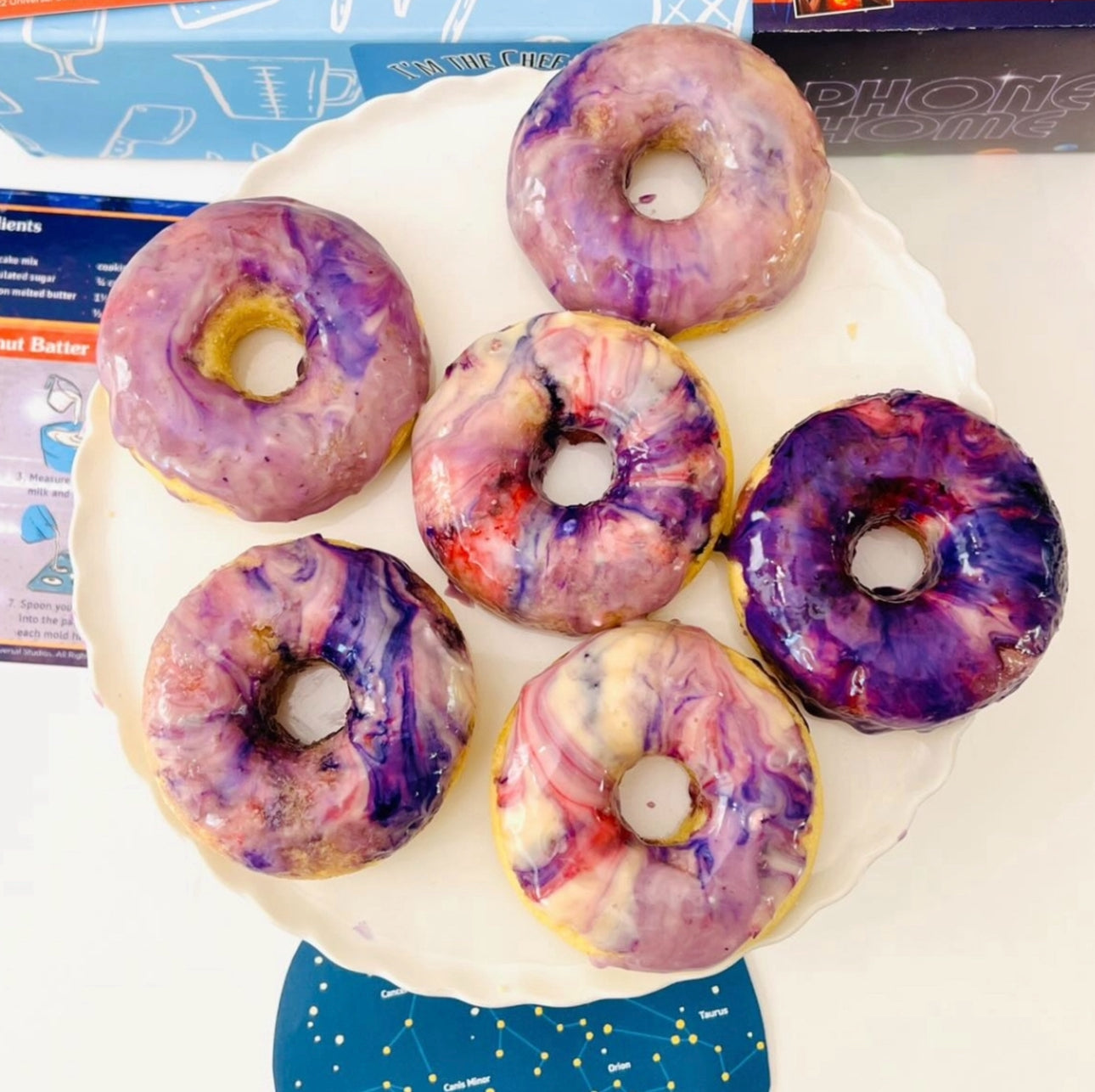
In our Galaxy Donut Kit, we take this a step further by blending astronomy with art. As children create galactic designs and learn about the colors of the nebula, they are engaging with the "geography" of the universe. This helps them understand Earth's place in the solar system. We are just one planet orbiting one star in a vast galaxy. This sense of scale is humbling and awe-inspiring for kids and adults alike.
Tips for Educators and Homeschoolers
If you are using geography crafts in a classroom or homeschool co-op, you can easily align these activities with national standards. Geography is often categorized into five themes: Location, Place, Human-Environment Interaction, Movement, and Region.
Integrating the Five Themes
- Location: Use the "Me on the Map" project to teach absolute and relative location.
- Place: Use the salt dough relief maps to describe the physical characteristics of a specific area.
- Human-Environment Interaction: Use the biome dioramas to discuss how humans adapt to or change their surroundings.
- Movement: Use the spice map activity to discuss how goods and ideas travel across the globe.
- Region: Use continent boxes (containers filled with photos, coins, and artifacts from a specific continent) to compare different parts of the world.
For group settings, we offer school and group programmes that provide structured, hands-on STEM and geography experiences. These are designed to be mess-managed and easy for educators to implement, ensuring that the focus remains on the joy of discovery rather than the stress of prep work.
Managing the Mess: Tips for Parents
We know that the phrase "papier-mâché" can strike fear into the hearts of parents who value their carpets. However, the benefits of hands-on learning far outweigh the cleanup time. Here are a few ways to keep the "edutainment" manageable:
- The Tray Method: Perform all dough-based or painting activities on a large rimmed baking sheet. This keeps the materials contained and makes it easy to move the project if you need the table for dinner.
- Prep in Advance: For projects like the salt dough map, measure out your ingredients before inviting the kids to the table. This prevents flour "snowstorms" in the kitchen.
- Embrace the Process: Remember that the goal is the learning, not a museum-quality masterpiece. If the "continents" on the globe look a little wonky, that’s okay! Your child is learning about proportions and spatial relationships regardless of the final aesthetic.
Bottom line: Geography crafts don't have to be overwhelming. With a little preparation and the right mindset, you can turn your kitchen table into a portal to the rest of the world.
Conclusion
Geography crafts for kids are more than just a way to pass a rainy afternoon. They are a powerful tool for building confidence, fostering curiosity, and teaching complex STEM concepts in a way that feels like play. By moving from the "me" to the "world," children develop a sense of belonging and a respect for the planet's diverse landscapes and cultures.
Whether you are baking erupting cakes, sculpting mountains out of dough, or mapping the stars in the night sky, you are providing your child with the skills they need to navigate their future. At I'm the Chef Too!, our mission is to make these moments of discovery as easy and delicious as possible. We want to help you create lasting memories that extend far beyond the classroom or the kitchen.
If you’re looking for a consistent way to bring these adventures home, consider joining The Chef's Club. Our monthly subscription delivers a new themed STEM adventure to your door, complete with pre-measured ingredients and specialty supplies. It’s the perfect way to keep the spirit of exploration alive all year round.
Next Step: Choose one activity from this list—perhaps the "Me on the Map" circles or a local treasure hunt—and set aside an hour this weekend to explore it with your child. You’ll be amazed at the questions they ask and the connections they make.
FAQ
What are the best geography crafts for preschoolers?
For younger children, focus on simple, visual projects like the "Me on the Map" layered circles or basic finger painting of the Earth. At this age, the goal is to introduce the idea that we live on a planet called Earth and that maps are pictures of places. Use bright colors and large shapes to keep them engaged.
How can I teach my child about the seven continents through art?
A great way to teach the continents is through "continent boxes" or a torn-paper map. Give your child seven different colors of paper, one for each continent, and have them tear out the general shapes to glue onto a blue background. Tearing paper instead of using scissors helps develop different fine motor muscles and allows them to focus on the relative size of each landmass.
For additional hands-on geography inspiration, explore the full collection of geography craft ideas.
What materials do I need for a DIY globe?
To make a papier-mâché globe, you will need a balloon, old newspapers, flour, water, and paint (blue, green, and brown). You may also want a small bowl to rest the balloon on while it dries. Once the base is finished, you can use markers or craft foam to add labels for the oceans and continents.
Can geography crafts help with middle school social studies?
Absolutely. For older children, geography crafts can be more technical, such as creating accurate topographical relief maps or plotting coordinates on a handmade grid. These projects help reinforce complex topics like tectonic plate movement, climate zones, and the historical impact of geographic barriers like mountain ranges and deserts.
Families and educators can also explore the full kit collection for additional hands-on learning adventures.